

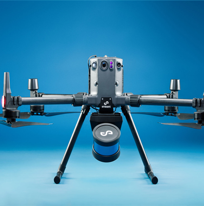
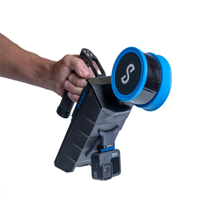
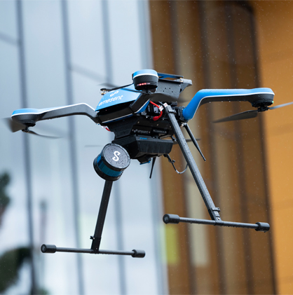
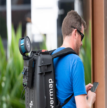


The Hovermap ST-X of the Emesent brand is a new product of survey-grade autonomous lidar scanning. It can provide high-quality data acquisition capabilities in harsh and GPS-free environments and will offer convenient, safe and efficient assistance for surveying some complex areas.
We are open to the national market and sincerely invite sales agents and industry partners. Welcome to consult and negotiate with us. For more information, please contact with our Sales Manager Mr. Chen at 0086- 18310350316
Surveying and mapping
Spatial information collection
Underground space exploration, highway and railway construction, tunnel engineering, and bridge reconstruction
Mining and mine safety
Architecture, infrastructure, forestry
Electric power application, cultural relics protection, national defense
Oil and gas as well as the film industry
Hovermap ST-X is based on the optimized SLAM algorithm and is applied to the acquisition of 3D spatial data in complex areas. It has irreplaceable advantages such as security, efficiency and simplicity. Compared with existing measurement technologies and traditional laser scanning technologies, drones take less time to collect data and reduce the chance of personnel being exposed to dangerous areas to a very low level, which can greatly improve operation safety and production efficiency.
The lidar scanning range of Hovermap ST-X is 300 meters. It can fly higher and faster, collect more than one million points per second, and collect detailed and accurate data over a large area in a shorter time - obtaining insight analysis results more quickly. Fewer flights are required for the scanning area, saving time for setting up, packaging and transferring, as well as splicing the scanning data.
Hovermap ST-X has multiple functions and is competent for collecting data in any environment. It can be installed on a drone for autonomous flight scanning, and the task can be completed even in an environment without GPS. It can be easily removed from the drone and used as a handheld, backpack or vehicle-mounted scanner. By combining these functions, data on existing facilities and digital twins can be collected within minutes, saving several hours compared to previous operations.
The Hovermap ST-X is designed to be sturdy and lightweight, featuring a weatherproof design. It can carry out operations in harsh environments - easily completing tasks both above and below ground, indoors and outdoors.
The scanning range of the lidar reaches up to 300 meters
It can scan over one million points per second
The scanning leaves no blind spots and enables detailed scanning of complex facilities or terrains
Outstanding vegetation penetration scanning capability
Realize the collection of survey-level point cloud data and view the data in real time while collecting it
The combination of long-range radio and continuous scanning enables rapid inspection and measurement operations
Strong autonomous ability
There are three modes of Hovermap ST-X:
Mapping scanning mode
Autonomy Autonomous flight point mode
Plus Pilot Assistance Mode
Fuselage:
Weight: 1.57 kilograms
Data acquisition/Maximum driving speed:
Vehicle-mounted: 60 kilometers per hour (37.3 miles per hour) Flight: Ground: 5 meters per second (16.4 feet per second), underground or confined space: 2 meters per second (6.6 feet per second)
Scan:
Lidar scanning range: 0.5 to 300 meters
Scanning mode: Simultaneous Localization and Mapping (SLAM)
On-board data storage capacity: 512GB Approximately 4 hours of scanning data
Point cloud attributes: intensity, range, time, number of echoes, number of scanning loops, RGB/ true color (optional)
Autonomous navigation
Waypoint setting and autonomous path planning in real-time 3D maps
The all-round range of the lidar is 1.2 to 40 meters (3.9 to 131 feet), the size of the obstacle is greater than 2 millimeters (3/32 inches) thick, and the adjustable safe distance during flight
Assisted flight: Flight without GPS, positioning and hovering, assisted flight, collision avoidance, and adjustment of flight speed